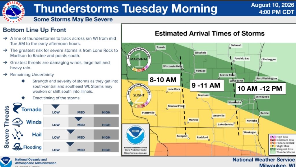



The National Weather Service Milwaukee/Sullivan Weather Forecast Office predicts as of Monday afternoon: “A large cluster of scattered-numerous storms, likely in a line, is expected to roll across southern WI and northern IL Tuesday morning. They should arrive between 9 – 11 a.m. in our area and exit by mid to late afternoon.
Frequent Lightning, heavy rain, and gusty winds (40-60 mph) are the main threats. The hail chance is lower and the tornado chance is much lower. Once that storm system clears, the chance for additional showers or storms will be small (15%) during the afternoon.