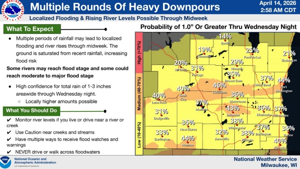




Multiple rounds of rain and storms are expected through midweek, bringing 1-3 inches of total rainfall.
- Severe storms are possible Today and Wednesday
- Severe weather potential has ended for the remainder of the overnight hours
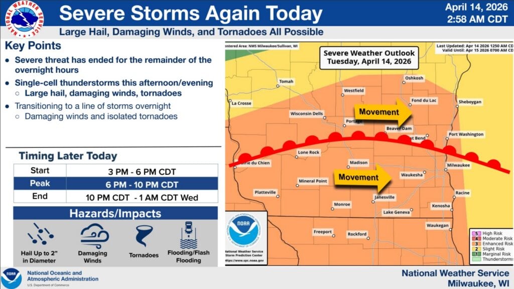
- This Afternoon through Tonight:
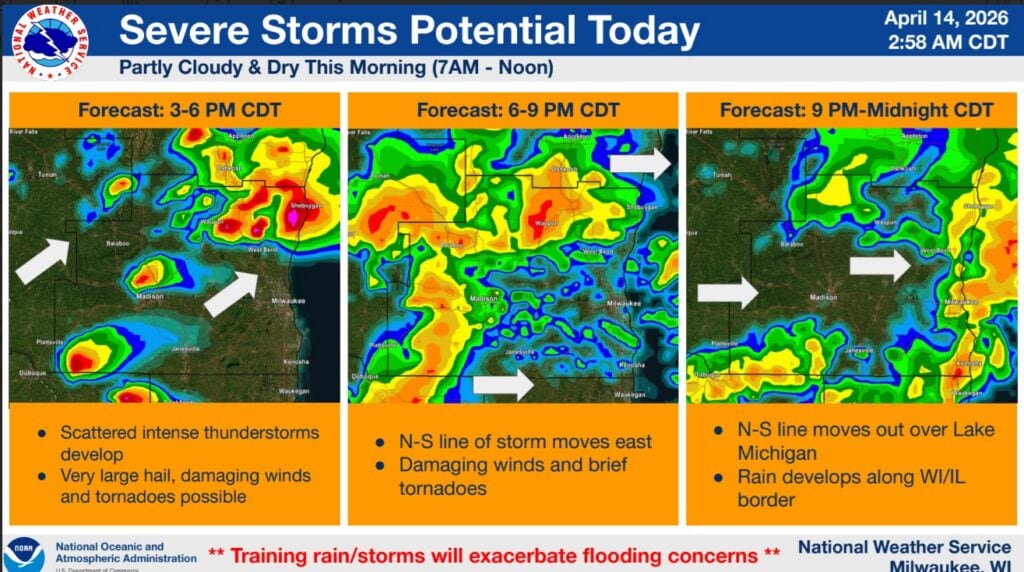
- Isolated to scattered severe storms in the afternoon/early evening.
- All hazards are possible: large hail, damaging winds, tornadoes and flooding.
- Isolated to scattered severe storms in the afternoon/early evening.
- This evening/night a north-south line of strong to severe storms will move through southern Wisconsin.
- Damaging winds and isolated tornadoes are the primary threat
- Training storm potential will exacerbate flooding concerns.
- Wednesday:
- Uncertainty remains on strong to severe storm chances.
- If conditions remain cooler with overcast skies, the chances for strong storms diminish.
- Small hail and flooding are the main concerns.
- If skies remain clear and temperatures warm, severe storm chances increase.
- All hazards are possible: large hail, damaging winds, tornadoes and flooding.