

According to the National Weather Service Milwaukee/Sullivan Weather Forecast Office
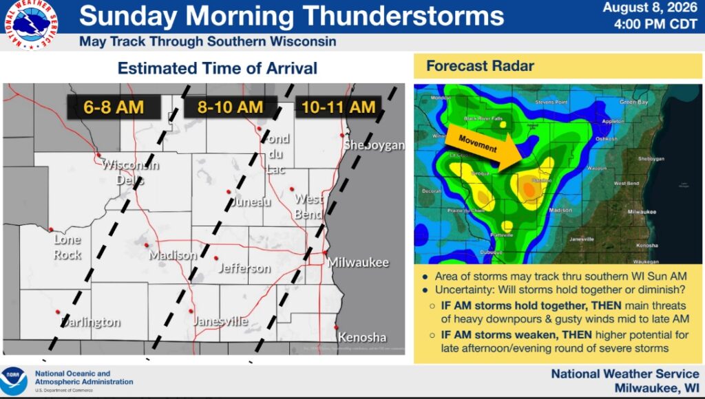
“An area of storms may track through southern WI Sunday morning between 6 AM and Noon. There is uncertainty about whether these storms will hold together or fizzle out.
Morning storms have the potential for heavy rain and gusty winds (cannot rule out a severe-level storm).
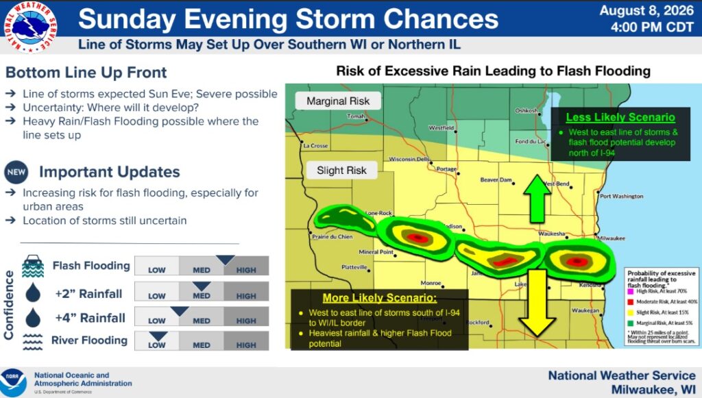
Sunday late afternoon or evening: a line of storms is expected to develop, but its location still remains uncertain. It will somewhat depend on how the morning round performs.
Wherever the line of storms sets up (either north or south of the WI/IL border), heavy rain and flash flooding is a threat, especially for urban areas.
Strong to severe thunderstorms (damaging wind gusts and isolated large hail) will be possible as these storms materialize. An isolated tornado can’t be ruled out.”