


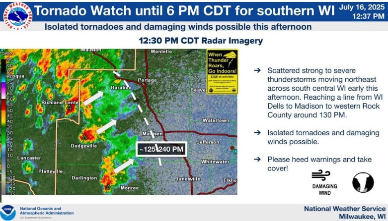
The National Weather Service has issued a Tornado Watch until 6 p.m. on Wednesday, July 16 for Jefferson, Rock and Walworth Counties. A watch indicates that conditions may be right for a tornado to form, but no tornadoes have yet been sighted.
Updated on 7/16 @ 10:30 a.m. with the image and narrative below. There is no major change from yesterday’s forecast.
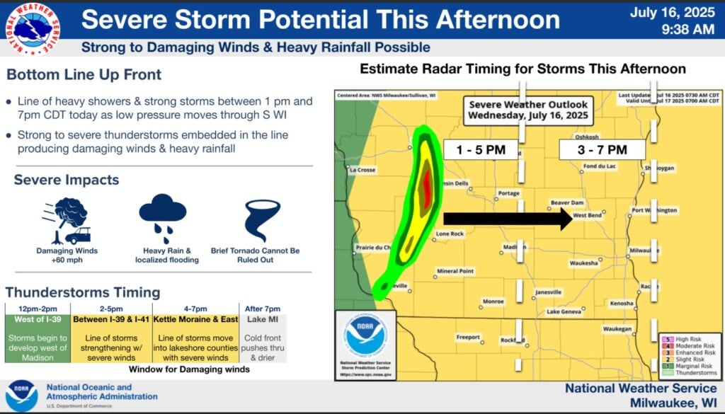
The National Weather Service Milwaukee/Sullivan Weather Forecast Office indicates that there is potential for strong to severe thunderstorms in our area on Wednesday afternoon and evening.
- A broken line of strong storms is expected to develop (between 12 PM to 2 PM CDT) in southwest and south central WI.
- The storms are expected to sweep eastward across the rest of the area between 2 PM this afternoon to 6 PM CDT this evening, before moving out over Lake Michigan after 7 PM CDT this evening.
- Some storms may become strong to severe (risk level 2 out of 5), with damaging wind gusts as the primary hazard, but cannot rule out an embedded, brief tornado.
- Heavy rainfall accompanying storms with 1-2 inches of rainfall and locally high pockets of >3″ mainly north of the I-94 corridor. Heavy rainfall over the same area for extended periods of time (+1 hr) would result in low-lying and urban and small stream flash flooding.