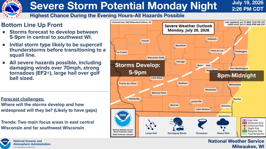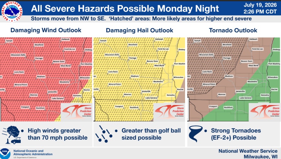




According to the National Weather Service there’s a potential for severe thunderstorms in our area on Monday night, mainly between 8 pm-Midnight, “with the environment looking favorable for some of these to potentially be some higher end severe storms.
As the storms develop and remain isolated, they will have the potential to become supercell thunderstorms that produce very large hail (larger than golf ball sized), damaging downburst winds (over 70 mph) and some tornadoes (some of which could be EF-2 level). As time progresses through the evening, the expectation is that these isolated supercell thunderstorms will merge into a squall line and produce a larger area for potentially damaging winds over 70 mph and some brief, quick spin up tornadoes along the leading edge.
The main question at this point is where/if the storms will develop. There appears to be a ‘cap’ or area of warm air ahead of the advancing cold front which may hold things back, at least in the afternoon. There also may be two earlier rounds of rain showers/storms that come through in the morning and early afternoon respectfully. There will still be smoke in the area, but this may not play much of a role with the storms primarily being in the evening/night hours.
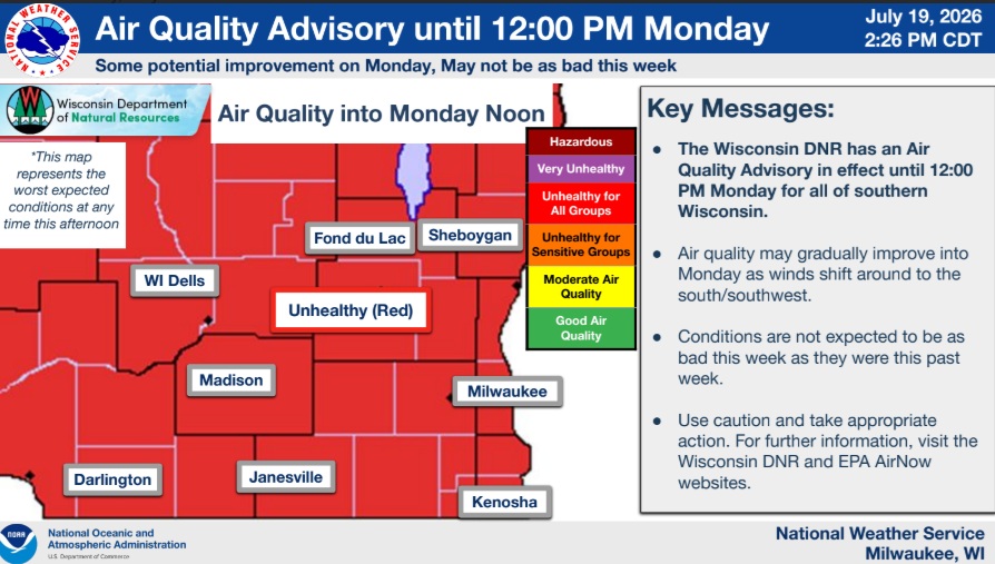
Air quality-wise, the advisory goes until 12 pm Monday and will be addressed by the DNR tomorrow morning. Initial trends seem to be favoring improvement Monday into Tuesday, possibly through the rest of the week.”