Editor’s note: The following was prepared by the National Weather Service – Milwaukee/Sullivan Weather Forecast Office as of 3:50 p.m. on Monday, November 14.
Here’s an update regarding wet, slushy snow for Tuesday into Wednesday.
Bottom Line Up Front:
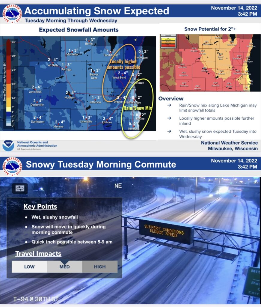
- Accumulating wet, slushy snow is expected to start during the Tuesday morning commute, continuing through Tuesday night, with light snow showers lingering on Wednesday.
- Highest snowfall amounts & increased impacts look to occur across east-central Wisconsin, due to lake enhancement.
- There is high uncertainty with snowfall amounts in far southeast Wisconsin, mainly around and south of Milwaukee, due to milder temperatures and some rain mixing in.
- With this being the first widespread accumulating snowfall of the season, expect some travel impacts.
Timing of snow:
- Snow begins 5-7 a.m. Tuesday morning, becoming widespread with a quick inch of snow accumulation by 9 a.m.
- Peak snowfall is expected mid-morning Tuesday through Tuesday evening.
- Light snow lingers through Wednesday.
What has changed?
- A quick inch of wet, slushy snow is expected to occur during the Tuesday morning commute, which may cause reduced visibility and slippery roads.
- There is high uncertainty with snow amounts in far southeast Wisconsin, mainly around and south of Milwaukee.

Editor’s note: The image on the homepage is by Gerd Altmann from Pixabay.


