



The Wisconsin DNR allowed the Air Quality Advisory for southeast WI to expire at 6 PM CDT Friday.
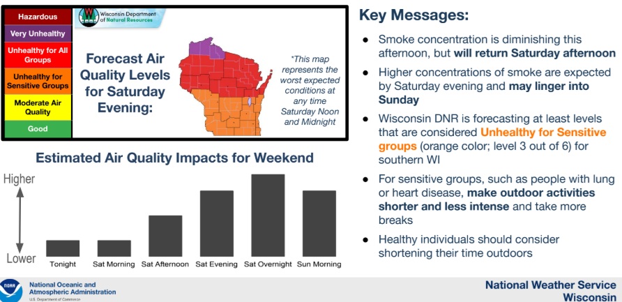
- The latest model guidance suggests smoke will return to southern Wisconsin later Saturday and then linger into Sunday. The approximate arrival windows are: lighter concentrations from 9 AM to Noon, moderate concentrations from 5 to 8 PM, and higher concentrations from roughly 8 PM to 2 AM Saturday. Continued northerly winds could thicken the smoke Saturday night. Light and variable winds will probably allow the smoke to linger into Sunday.
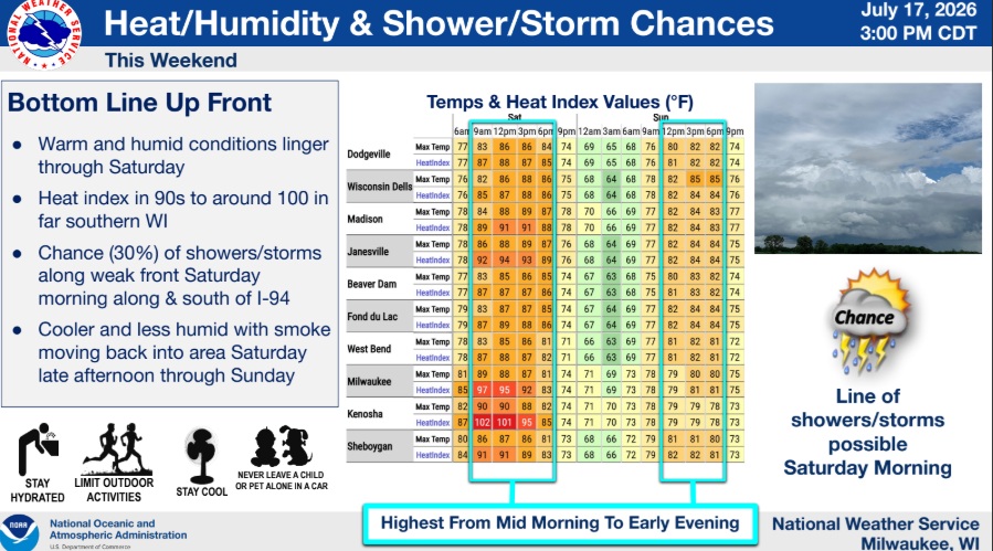
Heat and humidity persist into the first half of Saturday.
- Saturday: Air temperatures in the upper 80s, with heat index values in the upper 80s to middle 90s. Values may approach 100 in far southeast WI. A cooling trend kicks in from north to south in the afternoon.
- Sunday: Air temperatures in the lower to middle 80s, with identical heat index values. Noticeably lower humidity is anticipated. Slightly cooler temperatures are possible in far eastern Wisconsin due to a lake breeze.
Chance for showers and thunderstorms:
- Saturday: 20-40% chance of showers and storms (mainly south of I-94) along a front that will track southward during the morning hours. The main hazards would include gusty winds, small hail and cloud-to-ground lightning. The afternoon chance of storms trended downward and only includes far southeast WI.
- Sunday: Dry weather is expected.