


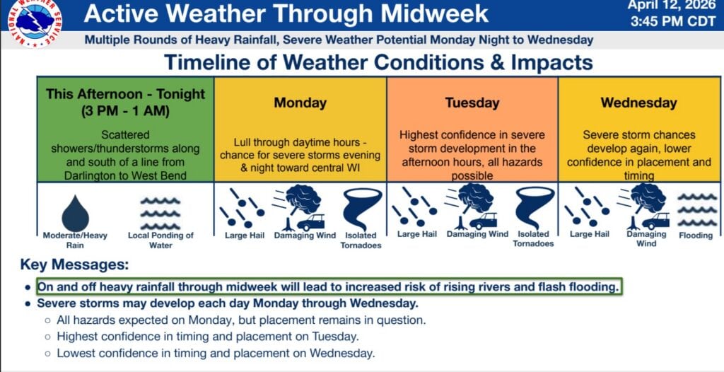
The National Weather Service Milwaukee/Sullivan Weather Forecast Office has provided the following guidance as of Sunday afternoon:
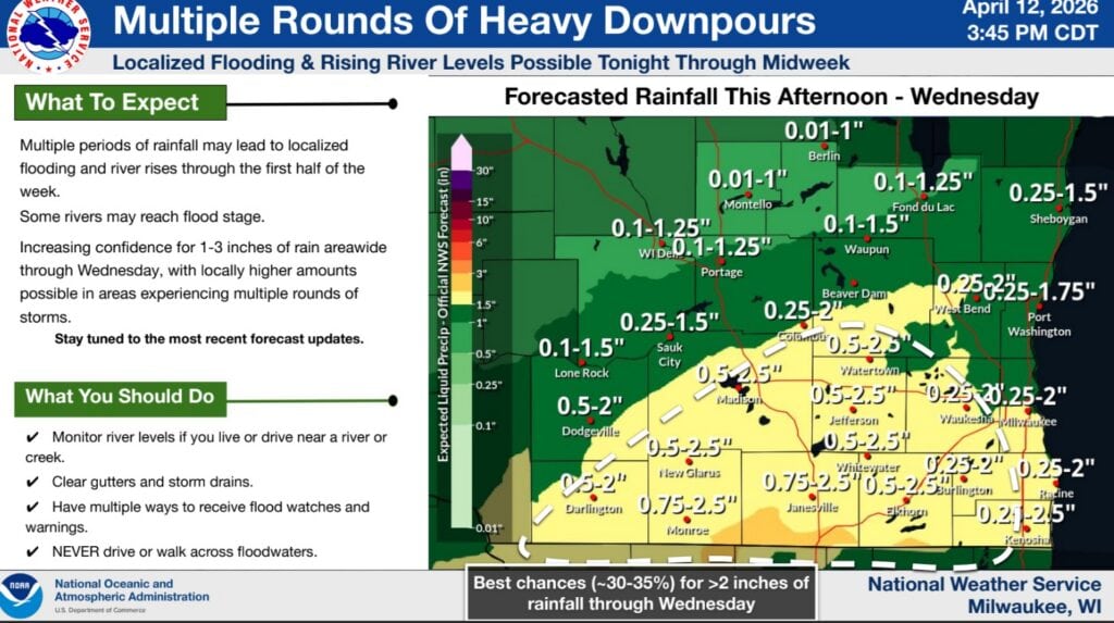
- Multiple rounds of rain and storms are expected through midweek, bringing 1-3 inches of total rainfall.
- Rounds of storms over similar areas (especially south-central to southeastern Wisconsin) will lead to ponding of water and river rises.
- Flash flooding becomes possible by midweek, as well as in localized areas in each individual round of rainfall.
- Severe storms are possible each day Monday through Wednesday.
- Monday: Primary concern across central Wisconsin, but this placement may shift north or south.
- Large hail, damaging winds, and isolated tornadoes are expected within storms that develop.
- Tuesday: Concern across all of southern and central Wisconsin, timing remains in question.
- Large hail, damaging wind, and isolated tornadoes possible.
- Training storm potential, exacerbating flooding concerns.
- Wednesday: Storm development possible across all of southern and central Wisconsin possible, placement remains in question.
- Hail, damaging winds, and flooding are the main hazards of concern.
- A trend southward may result in the primary hazard becoming only heavy rain and flooding.
- Monday: Primary concern across central Wisconsin, but this placement may shift north or south.


")


