



Per the National Weather Service Milwaukee/Sullivan Weather Forecast Office at 10:19 p.m. on Saturday:
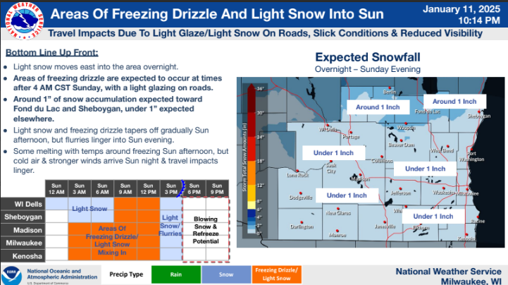
- Light snow will move east into the area overnight, continuing into Sunday.
- Areas of freezing drizzle are expected to occur at times after 4 AM CST Sunday, which may result in a light glazing on roads.
- Generally looking at snowfall totals around 1 inch toward Fond du Lac and Sheboygan, and under 1 inch elsewhere.
- Light snow and areas of freezing drizzle tapers off west to east gradually Sunday afternoon, but light snow/flurries may linger through the evening.
- Travel impacts may linger into Sunday evening.
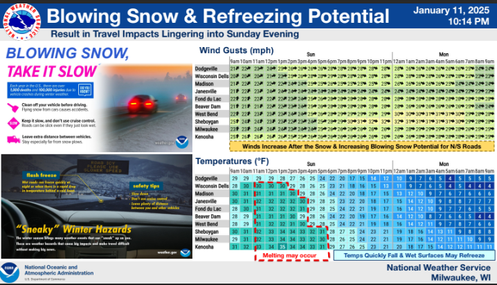
- Wet, Untreated Surfaces Refreeze Potential: Temps around freezing Sunday afternoon may result in melting, but temps quickly fall below freezing Sunday evening and untreated, wet surfaces may refreeze.
- Blowing Snow: Wind gusts pick up to around 25-30 MPH Sunday afternoon/evening, and there will be a growing potential for blowing snow across area roadways, especially for north to south orientated roads.