



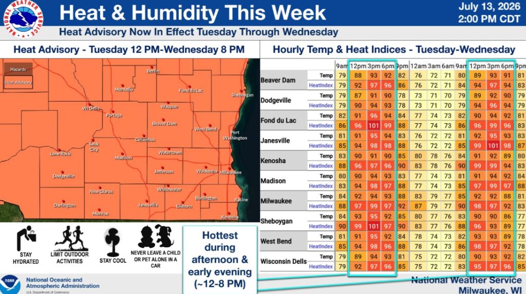
Per the National Weather Service Milwaukee/Sullivan Weather Forecast Office as of 2 p.m. on Monday:
A Heat Advisory is now in place across all of southern Wisconsin from Tuesday at 12 PM to Wednesday at 8 PM CDT.
- Hottest conditions are expected between 12-8 PM each day, with some relief occurring during the overnight hours
- Tuesday: air temperatures in the mid 90s, with heat indices in the upper 90s to low 100s
- Wednesday: air temperatures in the low to mid 90s, with heat indices in the upper 90s to potentially low 100s
While currently expected to stay below Heat Advisory thresholds, elevated heat and humidity will likely linger into Thursday & Friday.
- Thursday: air temperatures in the low 90s with heat indices in the mid-upper 90s
- Friday: air temperatures in the upper 80s to low 90s with heat indices in the low-mid 90s
Vulnerable groups and those spending prolonged periods of time outdoors should take heat precautions through this week.
Editor’s note: The Banner appreciates having permission to use the image on the homepage by geralt from Pixabay.