

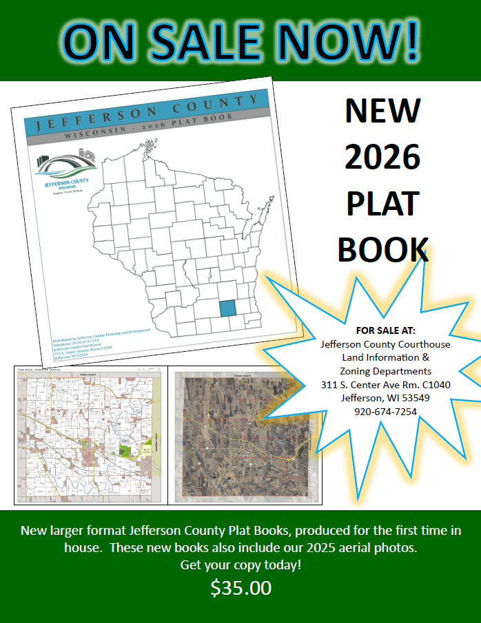
The Jefferson County Planning and Development Department is selling 2026 Plat Books to the public. Those interested can purchase copies for $35 each at the Jefferson County Courthouse, while supplies last.
A county plat book is a collection of maps that shows how land tracts are divided into municipalities and lots. It depicts land ownership, property boundaries, acreage, and other details about the land within a county’s borders.
The freshly updated 2026 Jefferson County Plat Book features a larger format that provides easier viewing of details and showcases new aerial photography completed in 2025. Employees from the Jefferson County Planning and Development team exhibited the Plat Book at the Wisconsin Land Information Association annual conference in February, earning a blue ribbon for First Place in their category.
“This is our first Plat Book produced entirely in-house, leveraging our employees’ land expertise and design skills,” said Matt Zangl, Jefferson County Director of Planning and Development. “These books are a great resource or gift for anyone who appreciates the rural spaces, agricultural land, parks and recreation resources, and all of the cities, towns, and villages that make Jefferson County a special place to call home.”
“Our Plat Books are especially useful when planning hunting excursions,” said Zangl. “They can differentiate land types, help identify parcel lines, and clarify property ownership.”
To purchase a Plat Book, visit the Jefferson County Courthouse, Land Information and Zoning Department (Room C1040), between 8:00 a.m. and 4:30 p.m. Monday through Friday. Cash, check, and credit card are accepted. If you have questions or would like more information, call 920-674-7254.
For more about Jefferson County:
jeffersoncountywi.gov