


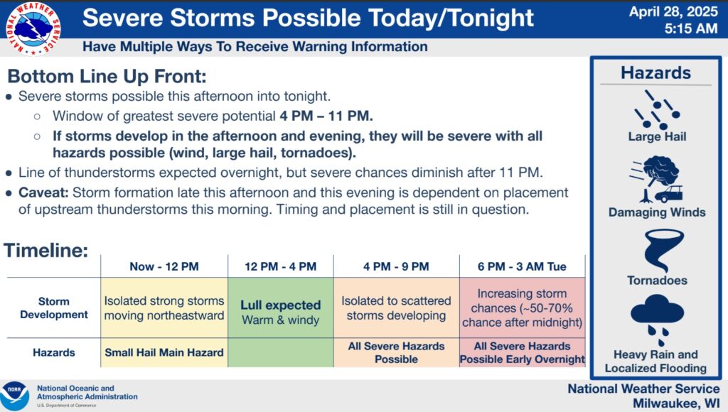
Per the 5:15 a.m. update from the National Weather Service on Monday, the following is the projected sequence of severe storm potential this afternoon and evening:
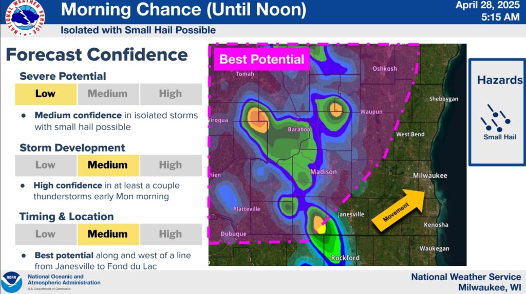
- Isolated to scattered storms now through 12 PM, with small hail possible.
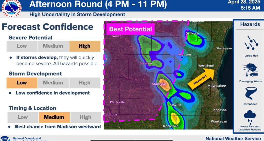
- Scattered severe storms developing this afternoon and evening.
- Window of greatest severe potential 4 PM to 11 PM.
- All hazards expected with any storms that develop (damaging wind, large hail, and tornadoes).
- Storm formation this afternoon and evening is dependent on placement of upstream thunderstorms this morning. Timing and placement remains in question.
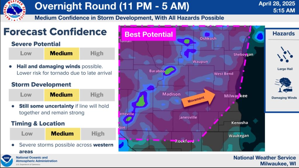
- A cold front with a line of associated thunderstorms will move west to east late tonight into early Tuesday morning.
- Large hail and damaging winds are the main threats with this line, mainly in western areas.


")


