


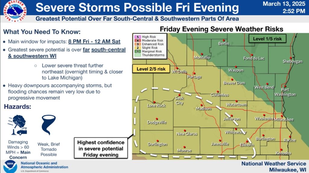
The National Weather Service Milwaukee/Sullivan Weather Forecast Office anticipates the following as of their Thursday afternoon update:
- A strong low pressure system will move through the Midwest Friday-Saturday, bringing gusty non-thunderstorm winds & chances for severe thunderstorms
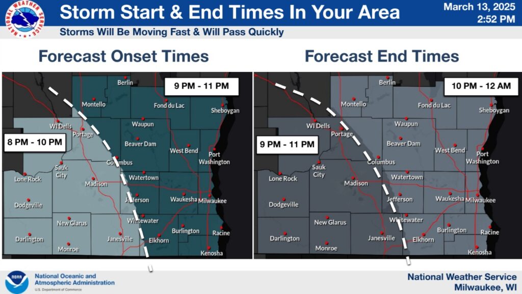
- Peak potential for showers, thunderstorms, and possible severe weather is between 8 PM Friday – 12 AM Saturday. Greatest potential is over far south-central and southwestern Wisconsin, with lower confidence further northeast
- Primary hazard in any Friday evening severe storms is damaging wind gusts in excess of 60 MPH. While far secondary to the damaging wind threat, a brief, isolated tornado can’t be entirely ruled out
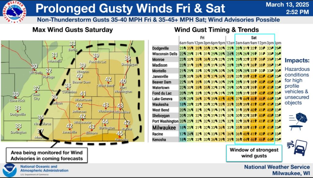
- The strongest non-thunderstorm wind gusts are expected Saturday afternoon, when Wind Advisories are possible over parts of the area


")


")


