

The National Weather Service Milwaukee/Sullivan Weather Forecast Office issued the following update on Saturday morning:
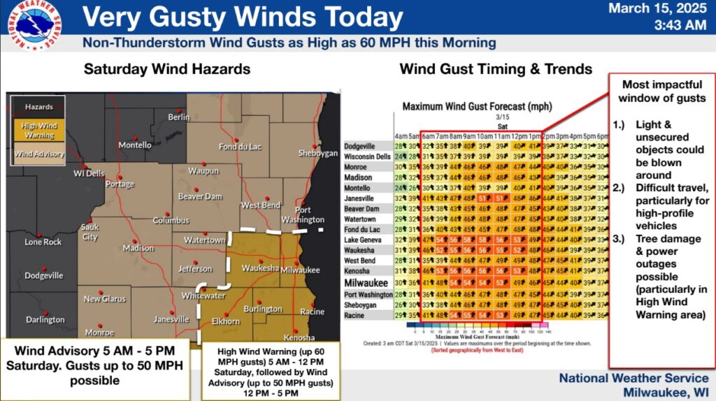
Very strong south to southwest winds are expected today, especially during the morning hours. These winds are not associated with thunderstorms. Wind Advisories are in effect for most of the area, with a High Wind Warning for southeastern Wisconsin [including the Whitewater area] from 5 AM through noon (with an Advisory in the afternoon).
Within the High Wind Warning area, gusts as high as 60 MPH are possible. Gusts to 50 MPH can be expected within the Advisory area.
Tree, powerline, and minor structural damage will be possible with these winds, especially in the warning area. In addition, any damaged trees or debris from the storms that moved through the area late Friday night will pose an additional hazard if blown around by the strong winds today.
Light snow will develop over southeastern and east central Wisconsin after midnight tonight, continuing into the morning hours on Sunday. Accumulations are currently expected to be around an inch or less, with the highest amounts across the far southeastern portions of the state.
Temperatures are expected to be around freezing, and accumulation will be greatest on grassy and elevated surfaces. Temperatures will then rise above freezing by mid-day Sunday, with most snow melting during the afternoon.