


Here is an update from the National Weather Service regarding both thunderstorms tonight and high heat values for Sunday into Monday.
Bottom Line Up Front
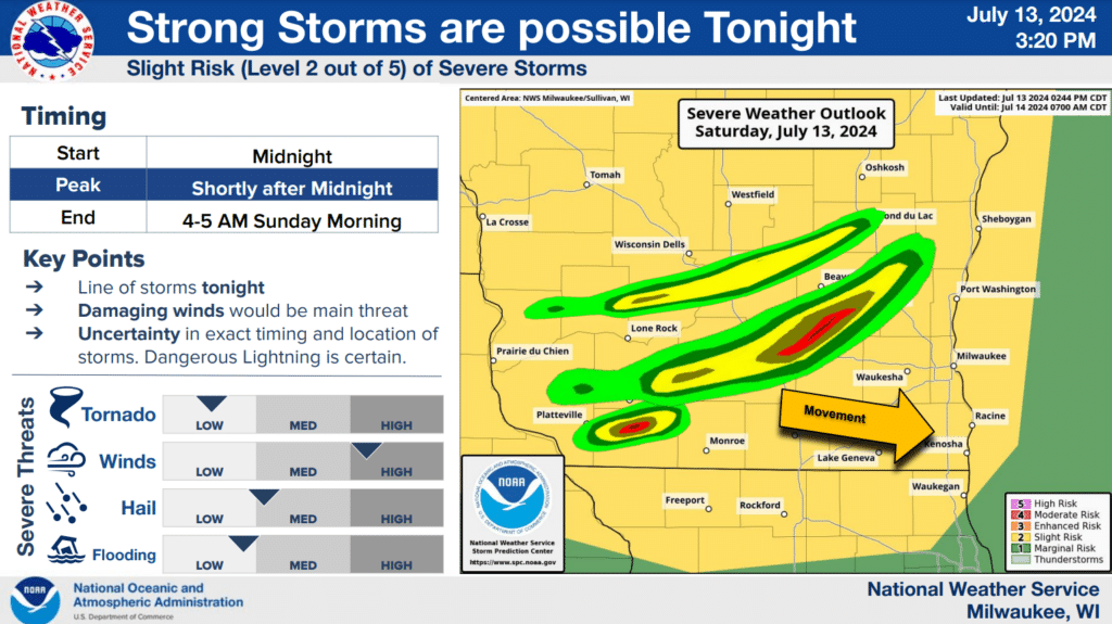
- A line or cluster of storms is expected to track from eastern MN to southern WI tonight. The time of arrival of these storms into south central WI should be between Midnight to 5 am early Sunday. A few showers or storms may linger after 5 am.
- A few strong thunderstorms should precede this main line this evening.
- Strong to severe storms are likely, with damaging winds the main threat
- Very heavy rainfall and dangerous lightning
- See attached graphics for more information
Heat and Thunderstorm Outlook
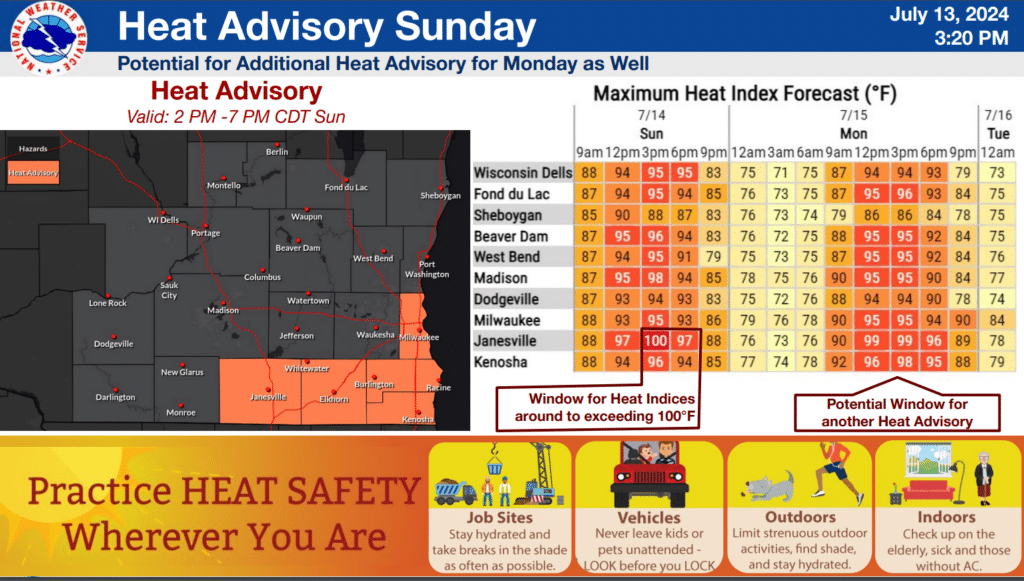
- Heat Advisory in effect starting 2 pm on Sunday.
- It will be hot and humid Sunday and Monday. Heat indices approaching both 100 degrees Sunday and Monday.
- Scattered Thunderstorms tonight and again late Sunday, higher chance Monday afternoon and night along an approaching front.
- Potential for severe storms Sunday and Monday. Currently, it looks like Monday afternoon and evening would be the most likely time period.
What has changed?
The addition of the Heat Advisory for parts of southern Wisconsin on Sunday.
Increasing confidence in a few rounds of strong to severe thunderstorms tonight, then again later Sunday into Monday.


")


")
