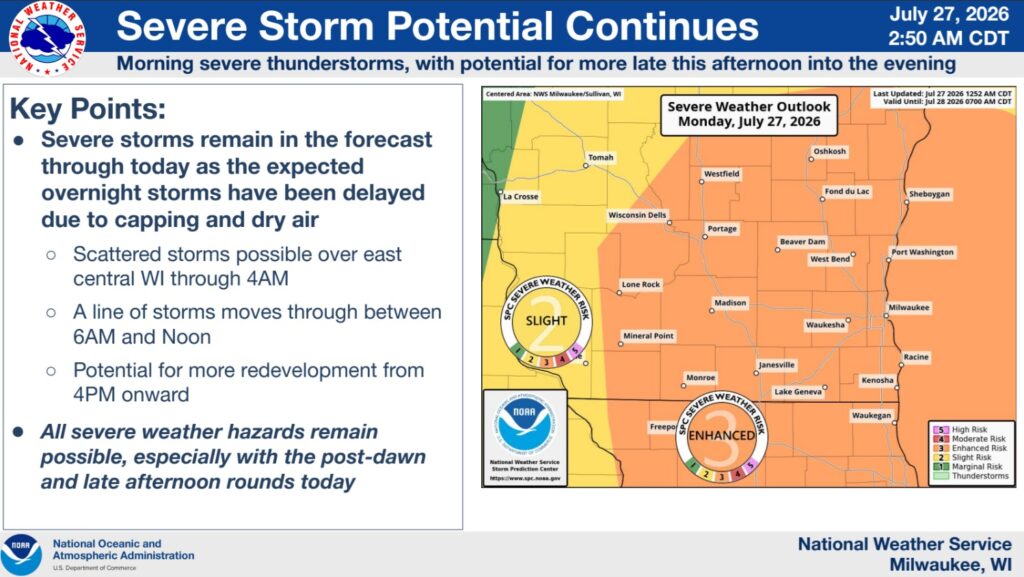




The National Weather Service Storm Prediction Center has maintained an Enhanced Risk (Level 3/5) for all of southern Wisconsin today. They indicate that “Overnight severe storms have been delayed due to capping and dry air over the state.” Weather capping, or a “cap,” is a layer of warm air aloft that suppresses the upward movement of air, preventing or delaying thunderstorm development. Arrival of a storm is now expected by noon. There’s a possibility of an additional thunderstorm after 4 p.m.
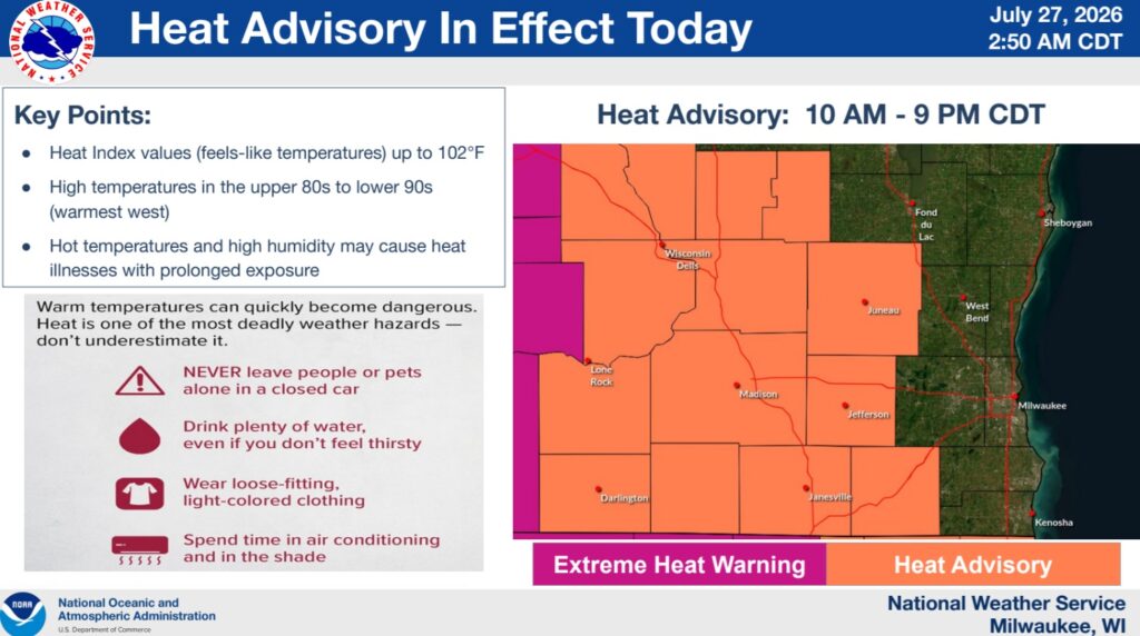
A heat advisory is in effect from 10 a.m. until 9 p.m. The heat index may reach 102 degrees.
- The Storm Prediction Center has maintained an Enhanced Risk (Level 3/5) for all of southern Wisconsin today.
- Overnight severe storms have been delayed due to capping and dry air over Wisconsin.
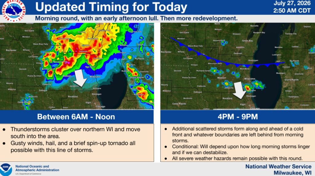
- Arrival is now projected between 6AM and Noon this morning.
- Gusty winds, hail, and a brief spin-up tornado can’t be ruled out with the morning round.
- A conditional threat for thunderstorm redevelopment is expected after 4PM, but will depend upon if we see enough sunshine and destabilize after the morning storms.
- Afternoon/evening storms would be more scattered, but also feature gusty winds, hail, and potential for an isolated, short-lived tornado.
- A Heat Advisory has also been issued from 10AM to 9PM today over south-central and southwest WI. Heat indices between 100 and 102 are anticipated.
- Morning storm coverage will influence heat headlines today. Less morning storm coverage would mean potentially higher heat indices.