

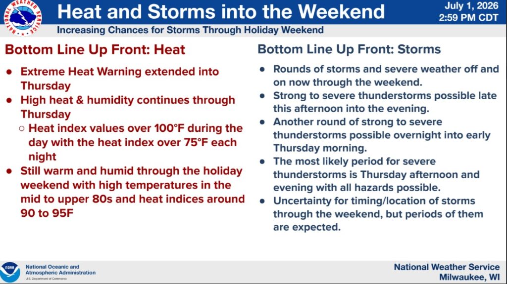
Numerous rounds of thunderstorms expected from now through the weekend. Severe thunderstorms with all hazards will be possible with each of these rounds. Two rounds of storms will be possible Wednesday evening followed by overnight. Thursday may be the most likely severe thunderstorm period with all hazards possible (damaging winds, large hail, tornadoes, flash flooding). Friday and beyond is fairly uncertain for storm potential and dependent upon what happens today/tomorrow.
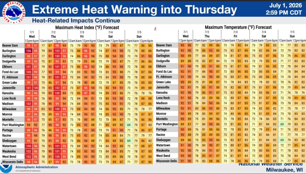
Heat-wise, the Extreme Heat Warning was extended through Thursday due to the potential of heat indices still getting into the 100F+ range. This is day 4 of the heat wave, so criteria for a warning is with the heat index hitting 100F+ now instead of 105F+. If storms and cloud cover lingers, these heat indices may not be as high. Conditions will remain on the warm and humid side through the holiday weekend.


")


")
