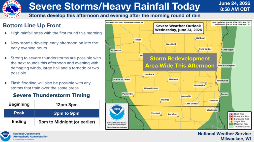


Per the National Weather Service Milwaukee/Sullivan Forecast Office, “An initial round of rain will move through southeastern Wisconsin by late morning. High rainfall rates could lead to some localized standing water in spots.
A new round of scattered thunderstorms is expected to develop this afternoon, possibly as early as 12 pm-3 pm, across anywhere in southern Wisconsin. A third round of rain/storms is expected into the late afternoon and early evening hours as well.
Strong to severe thunderstorms will be possible with any of the storms that develop this afternoon and evening. Damaging winds, large hail, flash flooding and a tornado or two are possible with any of the storms that develop over this period.
Looking ahead, there will be a pattern change starting Sunday with much warmer and humid air moving into Wisconsin. Details will emerge as we get closer, but typically these patterns can have periods of near Heat Advisory conditions (100F Heat Index) as well as lines of strong to severe thunderstorms that produce high winds. This setup appears to hold strong through much of next week and beyond the 4th of July weekend.