


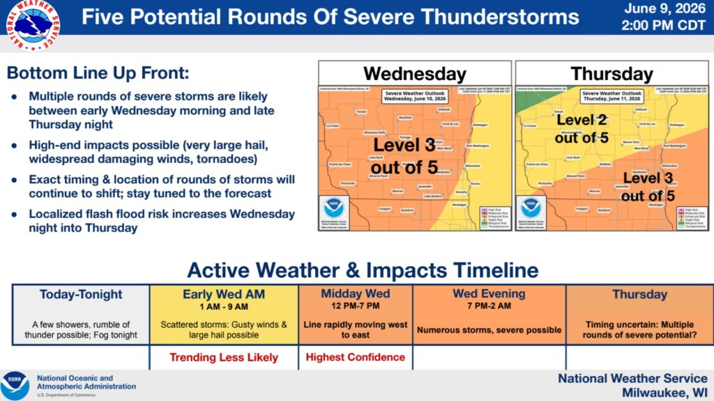
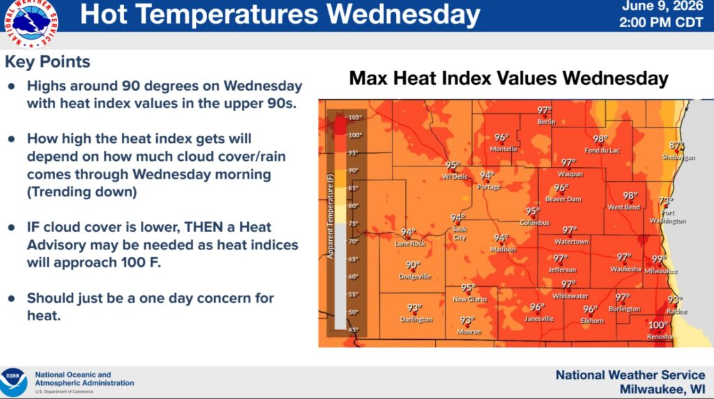
The National Weather Service Milwaukee/Sullivan Weather Forecast Office has issued the following guidance on Tuesday afternoon. In addition to the threat of severe thunderstorms, a heat index of nearly 100 degrees is anticipated on Wednesday.
- Multiple rounds of severe storms expected from early Wednesday morning to Thursday evening.
- Each round’s intensity will depend on the previous time period.
- Exact timing and location will likely shift – Keep an eye on the forecast.
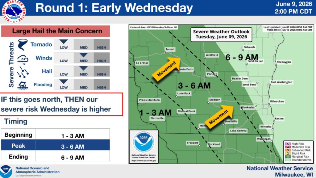
- Wednesday morning, scattered storms moving northeastward may produce gusty winds and large hail.
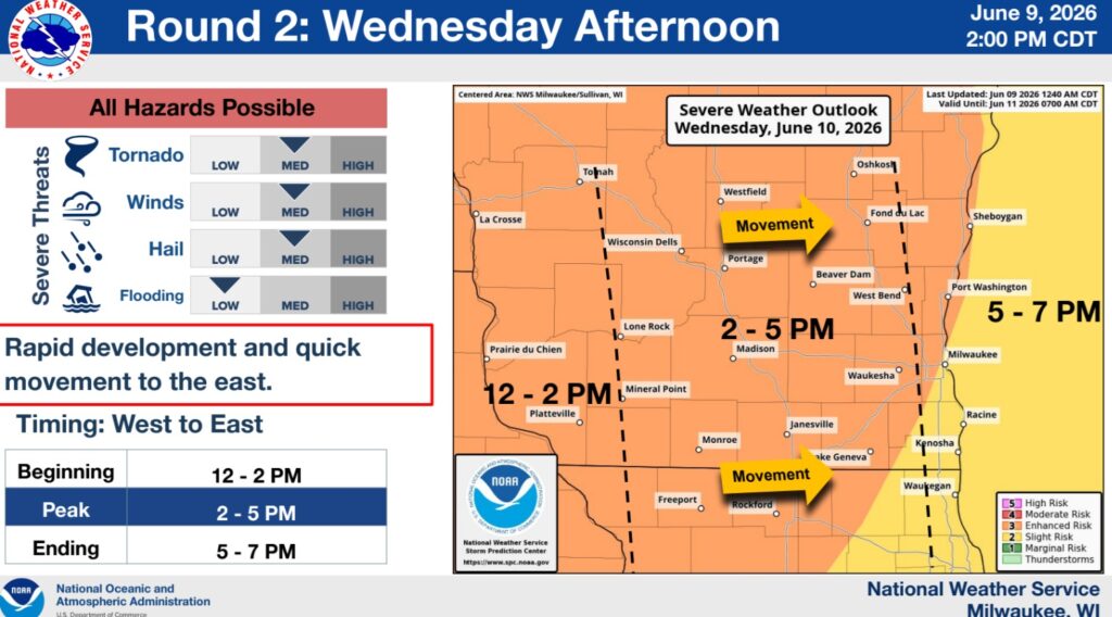
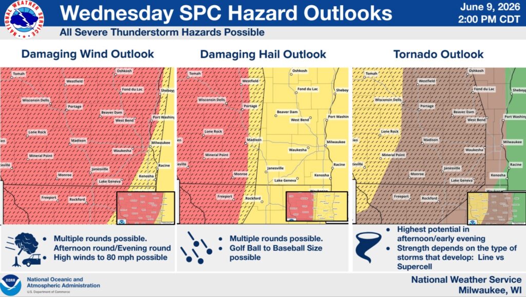
- Wednesday midday to Wednesday afternoon, a line of severe storms is expected to move eastward. All hazards are possible.
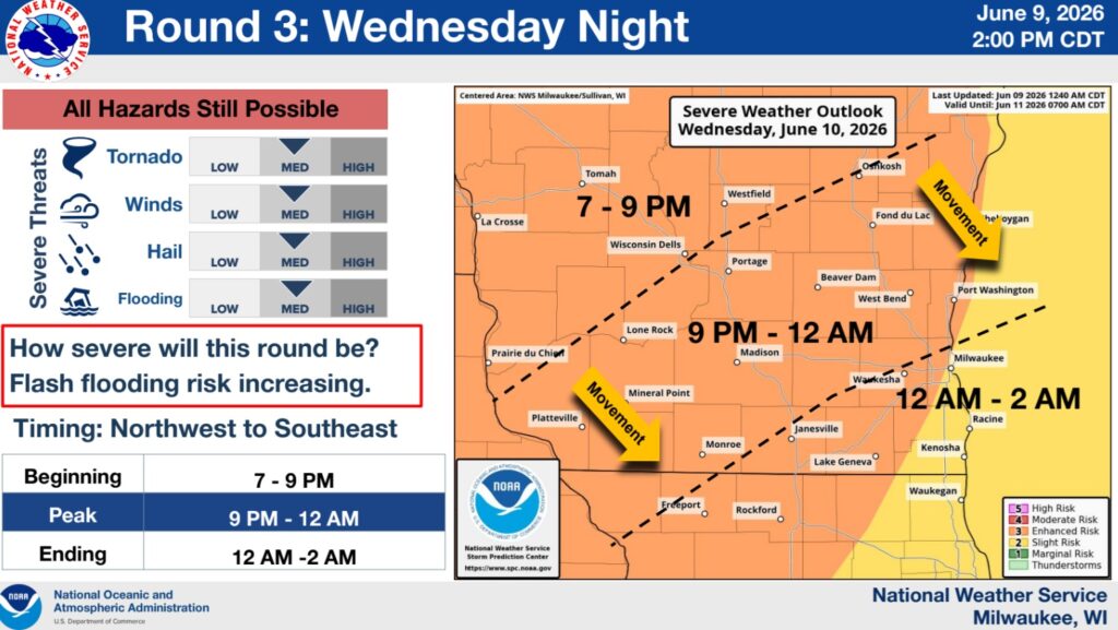
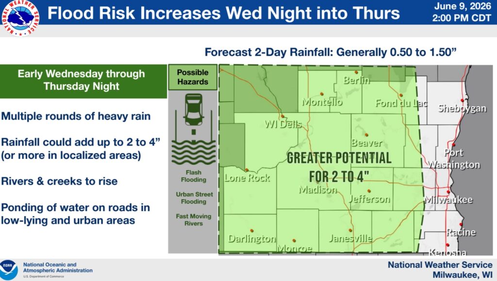
- Wednesday evening, storms continue and begin to produce flood risk. Severe storms are possible, but confidence is lower.
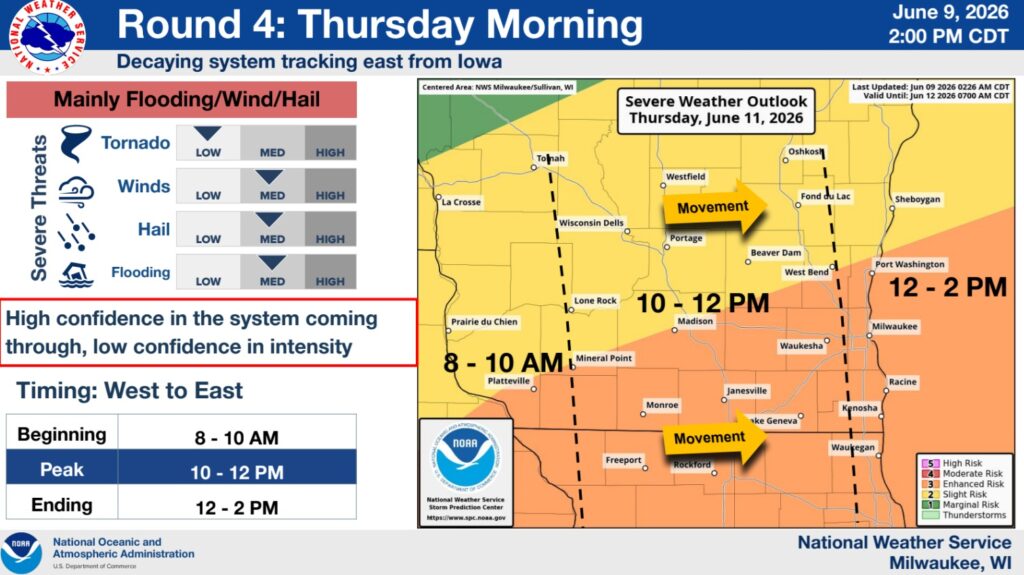
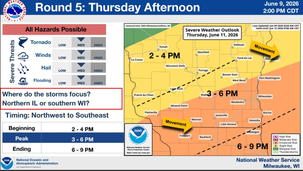
- Thursday, an additional round or two of storms is expected, but timing and placement remains in question. Flooding would become more likely through Thursday.


")


