

Updated 3/15/26 @ 10:30 p.m. to add the above image.
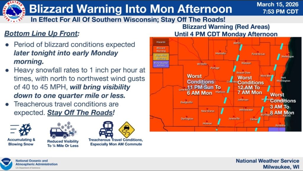
At 7:21 p.m. on Sunday the National Weather Service Milwaukee/Sullivan Weather Forecast Office [NWS] issued a Blizzard Warning effective until 4 p.m. on Monday, March 16, 2026. This warning is effective for all of southern Wisconsin.
The NWS warning includes the following statements: “After a brief break in precipitation, expecting heavy snow at rates to 1″/hr at times to work from west to east tonight. Northerly winds of 40 to 45 MPH combined with high snow rates will lead to blizzard conditions with visibilities less than 1/4 mile. Snow accumulations of 5 to 10 inches expected.
* IMPACTS…Travel could be very difficult. Widespread blowing snow will significantly reduce visibility. The hazardous conditions are expected to impact the Monday morning commute. Gusty winds could bring down tree branches.
PRECAUTIONARY/PREPAREDNESS ACTIONS…
Travel should be restricted to emergencies only. If you must travel, have a winter survival kit with you. If you get stranded, stay with your vehicle. The latest road conditions for the state you are calling from can be obtained by calling 5 1 1.
A Blizzard Warning means severe winter weather conditions are expected. Falling and blowing snow with strong winds are likely. This will lead to whiteout conditions, making travel extremely dangerous.”


")


