


The National Weather Service Milwaukee/Sullivan Weather Forecast Office provided the following forecast update at 3 a.m. on Friday, March 6.
Bottom Line Up Front
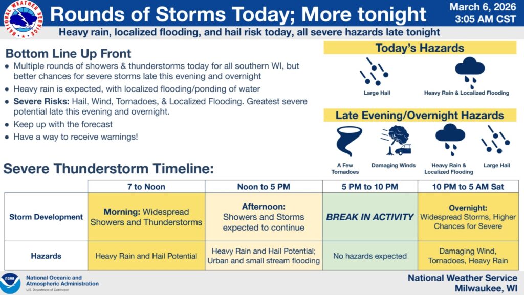
Confidence remains high for multiple rounds of thunderstorms this morning through early Saturday morning:
Friday Morning (~ 7 AM – 12 PM) (Confidence: High)
- A widespread area of showers and storms will move into southern Wisconsin from Iowa and Illinois.
- Areas of heavy rain and some hail will be the primary threat.
Friday Afternoon (~12 PM – 5 PM) (Confidence: High)
- Storms will likely continue for much of the afternoon over southern WI as they train into the area from Illinois or redevelop over southern WI.
- Areas of heavy rain, urban and small stream flooding, and some hail will be the primary threats.
— Break in activity from ~5 PM to 10 PM Today —
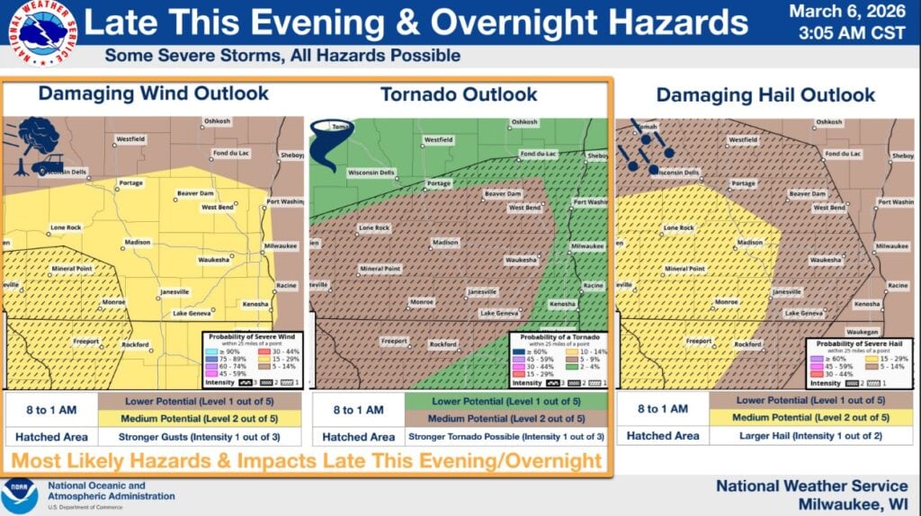
Overnight (~10 PM Tonight – 5 AM Saturday) (Confidence: Medium)
- Widespread storms track across the area along and ahead of a cold front.
- Damaging wind and a few tornadoes will be the primary threats.
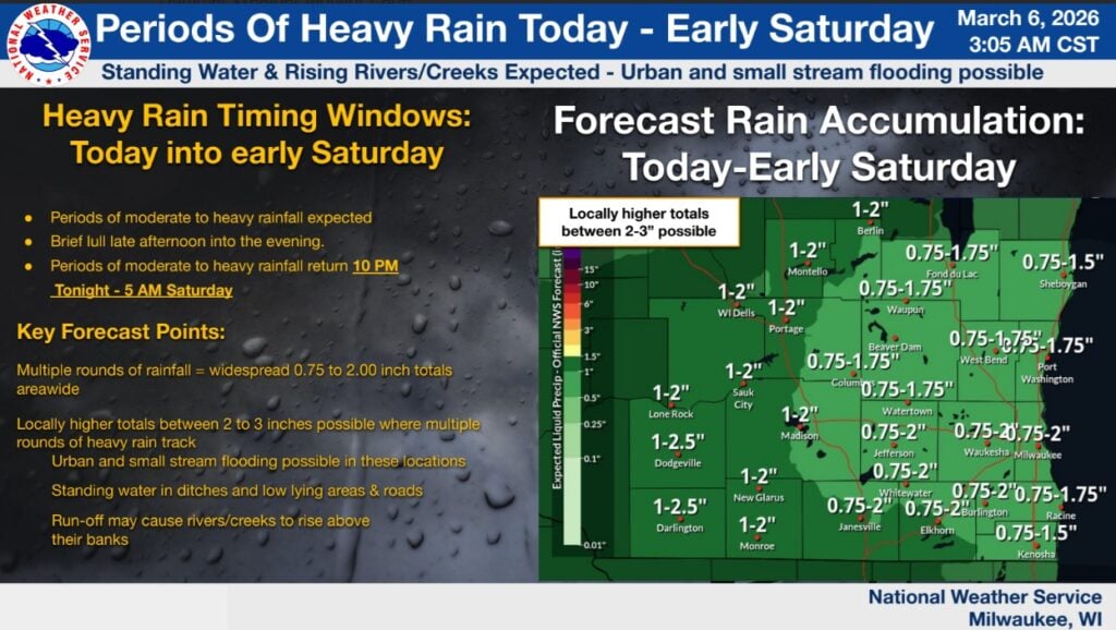
Heavy rainfall is expected with widespread accumulations between 1 and 2 inches areawide. Locally higher amounts from 2 to 3 inches may occur wherever thunderstorms repeatedly train throughout the day. Frozen ground and the rainfall will lead to:
- Standing water in ditches, as well as low-lying areas and roads
- Increased runoff and urban and small stream flooding.
What has changed?
- Later storm timing. A significant break in activity is now expected from 5PM to 10PM today.
- Greatest threats of tornadoes and damaging winds will be late this evening into the overnight. .
- Confidence in localized flooding remains high.


")


